This Region is at the validation stage and data is still being gathered.This Region is at the validation stage and data is still being gathered.
Dear Users and Contributors,
This Region continues to be work in progress and the material is not yet ready to be used. However, you may want to Download our products as data and charts and help to validate them, in order to ensure the best possible quality when we go operational.
In case you want to enroll in this project by becoming a contributor, please create an account on our website.Dear Users and Contributors,
This Region continues to be work in progress and the material is not yet ready to be used. However, you may want to Download our products as data and charts and help to validate them, in order to ensure the best possible quality when we go operational.
In case you want to enroll in this project by becoming a contributor, please create an account on our website.
The open flightmaps mission Die Mission von open flightmaps
The mission of the project is to develop and maintain a universal database of aeronautical data, in order to facilitate the rendering of high quality VFR maps to assist the general aviation community.
As the name suggests, a key part of the project is that it is an open source project which coordinates the work of a large community of volunteer contributors.
Die Mission: Entwicklung und Wartung einer allgemein und weltweit gültigen Datenbasis für aeronautischen Daten, um daraus die Erstellung qualitativ hochwertiger Sichtflugkarten und Navigationsdaten für die allgemeine Luftfahrt zu ermöglichen. Wie bereits der Name verdeutlicht ist das Schlüsselelement des Projekts, dass es sich dabei um ein “Open Source” Projekt handelt, das die Beträge einer großen Anzahl freiwilliger und ehrenamtlicher Mitarbeiter koordiniert.
About the ProjectÜber das Projekt
The database is administered by the open flightmaps association, or OFMA, a “not for profit” organization constituted especially for this purpose, which has the support of two universities and several associations of pilots and other organizations within the General Aviation community The structure of the OFMA database closely follows the AIXM Model recommended by Eurocontrol. The open flightmaps association (OFMA) grants you, under the OFMA General Users´ License a worldwide, royalty-free, non-exclusive license to use the data contained in the OFM Database, provided you abide by the conditions of the license. These rights explicitly include commercial use, and do not exclude any field of endeavour. To the extent possible these rights may be exercised in all media and formats whether now known or created in the future.
Die aeronautische Datenbasis wird von der Vereinigung “open flightmaps” (“OFMA”) betrieben, einem nicht gewinnorientierten Interessensverband, der speziell zu diesem Zweck gegründet wurde. Die OFMA wird dabei von zwei Universitäten und zahlreichen Piloten/Pilotinnen und Vereinen im Umfeld der Allgemeinen Luftfahrt unterstützt. Die Strukturen der dabei verwendeten OFMA-Datenbanken orientieren sich so weit wie möglich an dem von Eurocontrol vorgeschlagenen AIXM-Modell. Die OFMA ermöglicht Ihnen auf der Grundlage und in Übereinstimmung mit der Allgemeinen OFMA-User-Lizenz die Nutzung weltweiter, gebührenfreier, und nicht-exklusiver Daten aus dieser Datenbasis. Diese Rechte beinhalten ausdrücklich auch eine kommerzielle Nutzung und schließen keinen Anwendungsbereich aus. Diese Rechte gelten sinngemäß auch in größtmöglichem Umfang für alle existierenden und zukünftigen Medien und Formate.
Forum for data issues and alterationsForum zur Diskussion und Meldung von Datenänderungen
In case you want to report errors or alterations, please feel free to contact our originating contributors in this Forum. Möchten Sie Fehler oder anstehende Änderungen mitteilen? Bitte nehmen sie hier im Forum Kontakt auf.
Subscribe to our mailing list
Get informed about the latest and important data updates on the project.
Interested to participate?
Contact us
Please report to us in case of data alterations, as well as license requests to the following address:
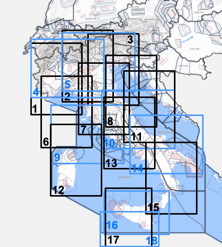
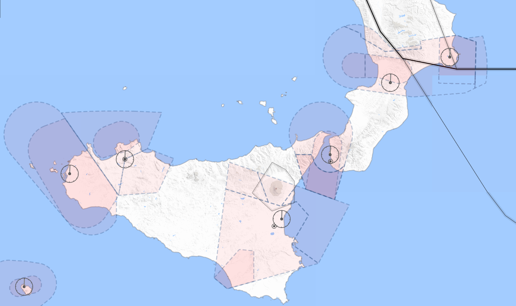
Openflightmaps will once again add another territory, Italy, to the countries covered by the project. This will take the new total up to 19 countries supported by the project.
It is important to emphasize that each one of these 19 territories require constant and rigorous maintenance, to ensure that all of the information is always current. The rate of progress is encouraging, since so far three new territories have been added in 2018, and there are some more in the pipeline.
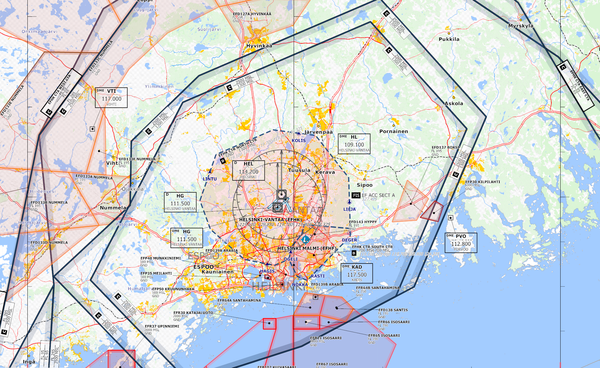
In early April 2018 openflightmaps will once again add another territory, Finland, to the countries covered by the project. This will take the new total up to 18 countries supported by the project. With Finland the openflightmaps project reaches into the Artic Circle, the furthest north of all of the territories supported by openflightmaps.
It is important to emphasize that each one of these 18 territories require constant and rigorous maintenance, to ensure that all of the information is always current. The rate of progress is encouraging, since so far two new territories have been added in 2018, and there are some more in the pipeline.
Big steps are being made to bring the data in finland up to publication level. We plan to issue the region within the next cycles – thanks to the AOPA Finland – main OFM contributor of this work. Here are some preview pictures of the Helsinki area:
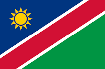
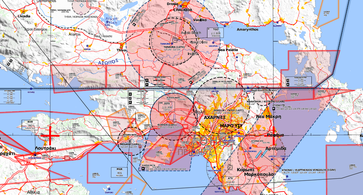
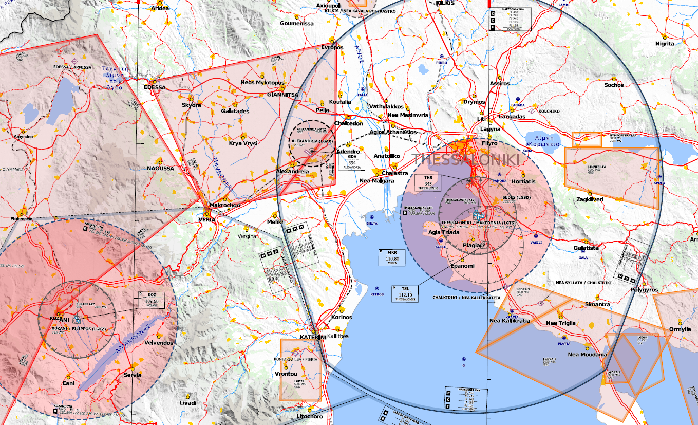
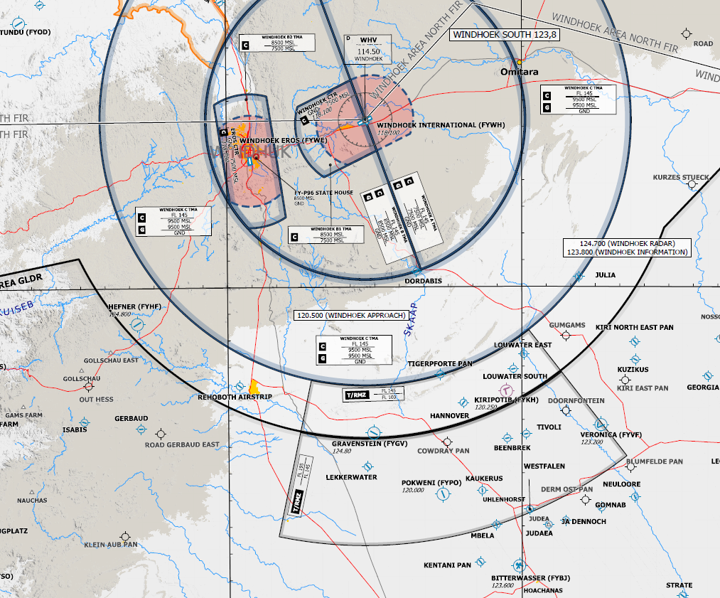
Finally we have added another two countries to the OFM Universe, Greece and Namibia. Data and Charts are online already, jobs for tiles are also being setup already, even if this will take a few more days.