how to use Application Interfaces
OFMA Application Interfaces
Pilots use a wide range of programs and software products provided on the market. The Idea of the application interfaces product is to make the interface to these applications as standard and easy as possible.
Further below on this page we formated the first installation instructions for the most common applications. We started with the applications “flightassistant” and “rocketroute”.
First Installation Instructions can be found here:
Today we provide the following additional formats to interface:
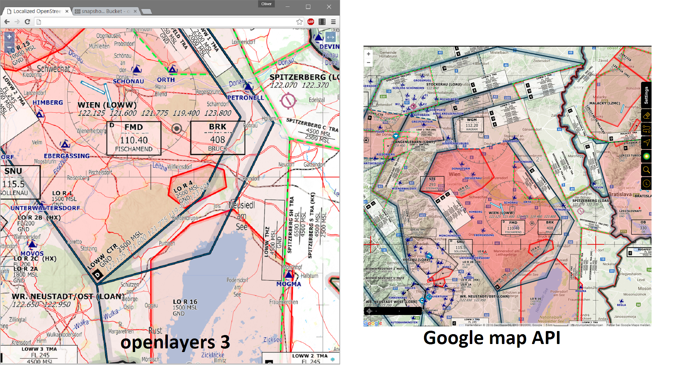
EPSG3857 Tiles
This is a widely used standard for displaying maps on devices or the web. All major map engines can easily interpret slippy tiles, such as the google maps api (web and android), binmaps api, openlayers, leaflet, …
You can consult the format specification here:
https://wiki.openstreetmap.org/wiki/Slippy_map_tilenames
Here a few examples:
Mapbox Tiles (mbtiles)
“.mbtiles” is a format introduced by mapbox and represents a good and easy solution to use locally stored tiles on mobile devices. There are two files for download at each OFM regional website, corresponding to either double or regular resolution, depending on the screen conditions of your target device. For instance, all newer Apple devices are using a “retina display”, using high dpi tiles.
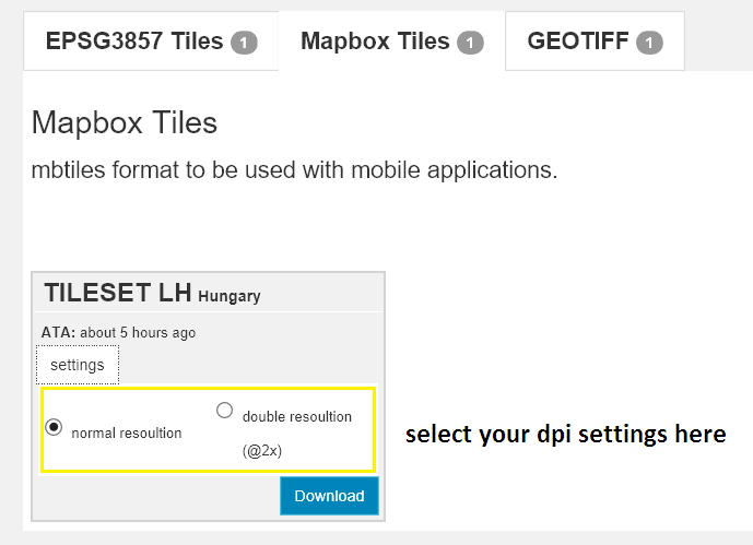
Format specification can be found here:
https://github.com/mapbox/mbtiles-spec
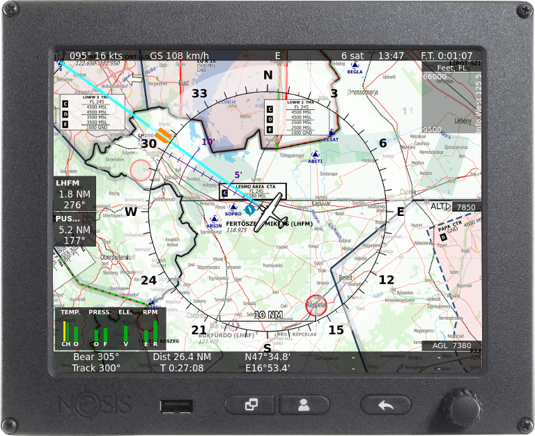
Geo Tiffs
The geotiff format represents a tif with geographic references – of any map projection – stored in the binary file, so that worldfiles or other geo reference files are not required.
Specifications can be found here:
https://www.gdal.org/frmt_gtiff.html
Geotiffs can be used in all types of applications, such as google earth or EFIS systems:

Supported applications and installation instructions
Today you can use OFM charts in the following applications:
-
Flight Assistant Application
powerful application for android – free to use.
-
Kanardia EFIS products, such as NESIS
EFIS products for Ultralight airplanes
-
Rocketroute applications
-
IFD EFIS products (ultralight airplanes)
-
LX navigation devices, such as ZEUS
In-cockpit navigation devices for gliders
-
LX nav devices, such as LX9000
In-cockpit navigation devices for gliders
Applications that are currently implementing OFM charts and which will become available in the short term
- PocketFMS VFR Flightplanning solutions
- fly is fun Android application
- airmate IOS application (freely available)
In discussion
- Air Navigation Pro: We have tried to persuade the people responsible for this excellent product to use the free OFM Charts, but to date we have not received a favorable response. We assume offering free charts gives rise to a conflict of interest with this company’s commercial map policy. We recommend that users of Air Navigation Pro who would like to benefit from the enhanced features offered by the OFM Charts, express their wishes to the Air Navigation Pro support team.
New Developments or Interfaces
If you considering using OFM charts, or use them already and need some assistance, please let us know by sending an email to: [email protected].
We are also interested in collecting installation instructions for other applications on this website – if you have developed an istallation for another product, or are considering developing one, please let us know, so that we can publish it here.